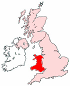
Map of St David's Wales and Surrounding Areas
Detailed street map of St David's city centre and the surrounding areas, towns & villages.
View Larger Map |
||
 |
||
St David's Map Wales Showing the City and its Surroundings
Street Map of the Welsh City of St David's: Find places of interest in the city of St David's in Dyfed, Wales UK, with this handy printable street map. View streets in the centre of St David's and areas which surround St David's, including neighbouring villages and attractions. Large St David's map.
Places of interest in and surrounding St David's, Dyfed include: Tabernacle Presbyterian Church of Wales, The Glendower Guest House, St David's Bed and Breakfast, Pwll Trefeiddan, St David's Post Office, The Refectory at St David's, The Sampler Tea Room & Museum, Bishop's Palace, Dowrog Pool, St David's Surgery, Lleithyr Farm (Caravan & Camping), The Farmers Arms Pub, Caerfai Bay Caravan & Tent Park, St Bride's Bay, St David's Fire and Rescue Station, St David's High Street, The River Alun, St David's Cathedral and more.
Highlights of This St David's Dyfed Map:
- Easy to Print Map for City Centre of St David's.
- Get a Satellite View of St David's.
- Find Routes To and From St David's area.
- View Villages and Towns Around St David's.
- Identify St David's Areas of Interest.
- See St David's Housing & Industrial Estates.
- Easily Find St David's Tourist Attractions.
- Zoom in, Pan and Move Around St David's.
- See Rivers, Canals, Lakes and Waterways.
The Post Code for St David's is: SA62
Locate streets and roads in and near St David's, locate interesting places and attractions in and near St David's, locate churches and religious centres in and near St David's, locate hospitals and health centres in and near St David's, locate towns and villages surrounding St David's area.
More Maps of Wales:
- Map of Bangor Area & Surroundings Wales
- Map of St Asaph Area & Surroundings Wales
- Map of Porthmadog Area & Surroundings Wales
- Map of Rhuddlan Area & Surroundings Wales
- Map of Llanfairfechan Area & Surroundings Wales
Maps English Towns|Maps Spanish Towns | Eire Town Maps | France Town Maps | Hants