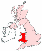
Map of Port Talbot Wales and Surrounding Areas
Detailed street map of Port Talbot town centre and the surrounding areas, towns & villages.
View Larger Map |
||
 |
||
Port Talbot Map Wales Showing the Town and its Surroundings
Street Map of the Welsh Town of Port Talbot: Find places of interest in the town of Port Talbot in West Glamorgan, Wales UK, with this handy printable street map. View streets in the centre of Port Talbot and areas which surround Port Talbot, including neighbouring villages and attractions. Large Port Talbot map.
Places of interest in and surrounding Port Talbot, West Glamorgan include: Neath Port Talbot Hospital, The Grand Hotel, The River Avan, Blanco's Hotel & Restaurant, Taibach, Reubans Pub, Glan Afan Comprehensive School, Baglan Moor, Bethlehem Evangelical Church, Port Talbot Train Station (Railway Station), Penycae, Sandfields, St Paul's Church, Dock Feeder, The Round House Restaurant, The A48, Margam Forest, Hollywood Park, The M4 Motorway, Vivian Park, Afan Lido Football Club, Port Talbot Bus Station, Talbot Athletic Ground, St Joseph's RC Junior School, St Joseph's Catholic Church, Port Talbot Station, Port Talbot YMCA, Aberavon, Aberafan Shopping Centre, The Princes Royal Theatre, Talbot Memorial Park, St Theodore Church and more.
Highlights of This Port Talbot West Glamorgan Map:
- Easy to Print Map for Town Centre of Port Talbot.
- Get a Satellite View of Port Talbot.
- Find Routes To and From Port Talbot area.
- View Villages and Towns Around Port Talbot.
- Identify Port Talbot Areas of Interest.
- See Port Talbot Housing & Industrial Estates.
- Easily Find Port Talbot Tourist Attractions.
- Zoom in, Pan and Move Around Port Talbot.
- See Rivers, Canals, Lakes and Waterways.
The Post Code for Port Talbot is: SA12
Locate streets and roads in and near Port Talbot, locate interesting places and attractions in and near Port Talbot, locate churches and religious centres in and near Port Talbot, locate hospitals and health centres in and near Port Talbot, locate towns and villages surrounding Port Talbot area.
More Maps of Wales:
- Map of Aberdare Area & Surroundings Wales
- Map of Cwmbran Area & Surroundings Wales
- Map of Wrexham Area & Surroundings Wales
- Map of Llanelli Area & Surroundings Wales
- Map of Bridgend Area & Surroundings Wales
Maps English Towns|Maps Spanish Towns | Eire Town Maps | France Town Maps | Hants