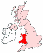
Map of Penarth Wales and Surrounding Areas
Detailed street map of Penarth town centre and the surrounding areas, towns & villages.
View Larger Map |
||
 |
||
Penarth Map Wales Showing the Town and its Surroundings
Street Map of the Welsh Town of Penarth: Find places of interest in the town of Penarth in South Glamorgan, Wales UK, with this handy printable street map. View streets in the centre of Penarth and areas which surround Penarth, including neighbouring villages and attractions. Large Penarth map.
Places of interest in and surrounding Penarth, South Glamorgan include: The Windsor Arms Pub, The Glendale Hotel, Alexandra Park, Eastbrook Train Station, Penarth Registry Office, Lower Penarth, Cogan Railway Station, Penarth Conservative Club, St Joseph RC Church, Penarth Leisure Centre, St Augustine's Church, Penarth Quay marina, Cogan, Barrage South Waterbus Stop, The River Taff, Cosmeston, Penarth High Street, Eastbrook, Penarth Train Station (Railway Station), Penarth Pier and Waterbus Ferry Terminal, Llandough Hospital, The Holy Nativity Church, St Dochowy's Church, The Golden Lion, Station Road Surgery, Llandough, Penarth Library, Plassey Square, Penarth Station, Hickman Lodge, Penarth Haven, Headlands School and more.
Highlights of This Penarth South Glamorgan Map:
- Easy to Print Map for Town Centre of Penarth.
- Get a Satellite View of Penarth.
- Find Routes To and From Penarth area.
- View Villages and Towns Around Penarth.
- Identify Penarth Areas of Interest.
- See Penarth Housing & Industrial Estates.
- Easily Find Penarth Tourist Attractions.
- Zoom in, Pan and Move Around Penarth.
- See Rivers, Canals, Lakes and Waterways.
The Post Code for Penarth is: CF64
Locate streets and roads in and near Penarth, locate interesting places and attractions in and near Penarth, locate churches and religious centres in and near Penarth, locate hospitals and health centres in and near Penarth, locate towns and villages surrounding Penarth area.
More Maps of Wales:
- Map of Risca Area & Surroundings Wales
- Map of Shotton Area & Surroundings Wales
- Map of Pontypridd Area & Surroundings Wales
- Map of Rhyl Area & Surroundings Wales
- Map of Colwyn Bay Area & Surroundings Wales
Maps English Towns|Maps Spanish Towns | Eire Town Maps | France Town Maps | Hants