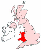
Map of Aberystwyth Wales and Surrounding Areas
Detailed street map of Aberystwyth town centre and the surrounding areas, towns & villages.
View Larger Map |
||
 |
||
Aberystwyth Map Wales Showing the Town and its Surroundings
Street Map of the Welsh Town of Aberystwyth: Find places of interest in the town of Aberystwyth in Dyfed, Wales UK, with this handy printable street map. View streets in the centre of Aberystwyth and areas which surround Aberystwyth, including neighbouring villages and attractions. Large Aberystwyth map.
Places of interest in and surrounding Aberystwyth, Dyfed include: Aberystwyth Library, The A487, Gannets Bistro Restaurant, St Michael's Church, The Academy Pub, The University of Wales, Bronglais General Hospital, The Commodaore Cinema Aberystwyth, Aberystwyth High Street, Aberystwyth Post Office, Aberystwyth Station, The Court Royale Hotel, The Inn on the Pier, The Coopers Arms Pub, Aberystwyth Bus Station, Penyranchor, St Paul Methodist Church, Aberystwyth Train Station (Railway Station), Llangawsai, Trefechan, Aberystwyth Castle, Aberystwyth Tourist Office, The National Library of Wales, Aberystwyth University of Wales and more.
Highlights of This Aberystwyth Dyfed Map:
- Easy to Print Map for Town Centre of Aberystwyth.
- Get a Satellite View of Aberystwyth.
- Find Routes To and From Aberystwyth area.
- View Villages and Towns Around Aberystwyth.
- Identify Aberystwyth Areas of Interest.
- See Aberystwyth Housing & Industrial Estates.
- Easily Find Aberystwyth Tourist Attractions.
- Zoom in, Pan and Move Around Aberystwyth.
- See Rivers, Canals, Lakes and Waterways.
The Post Code for Aberystwyth is: SY23
Locate streets and roads in and near Aberystwyth, locate interesting places and attractions in and near Aberystwyth, locate churches and religious centres in and near Aberystwyth, locate hospitals and health centres in and near Aberystwyth, locate towns and villages surrounding Aberystwyth area.
More Maps of Wales:
- Map of Connah's Quay Area & Surroundings Wales
- Map of Gelligaer Area & Surroundings Wales
- Map of Buckley Area & Surroundings Wales
- Map of Prestatyn Area & Surroundings Wales
- Map of Abergele Area & Surroundings Wales
Maps English Towns|Maps Spanish Towns | Eire Town Maps | France Town Maps | Hants